

Earth Engine Tutorial #30: How to get image properties and descriptive statistics


This tutorial shows you how to retrieve basic properties (metadata) of an Earth Engine image and how to calculate descriptive statistics (e.g., min, max, mean, std, sum).
Requirements
- geemap - A Python package for interactive mapping with Google Earth Engine, ipyleaflet, and ipywidgets
Installation
conda create -n gee python=3.7
conda activate gee
conda install mamba -c conda-forge
mamba install geemap -c conda-forge
Resources
Notebook:
Demo

Video
Import libraries
import ee
import geemap
Create an interactive map
Map = geemap.Map()
Map
Add images to the map
centroid = ee.Geometry.Point([-122.4439, 37.7538])

landsat = ee.ImageCollection('LANDSAT/LC08/C01/T1_SR') \
    .filterBounds(centroid) \
    .first()

landsat_vis = {
    'min': 0,
    'max': 3000,
    'bands': ['B5', 'B4', 'B3']
}

Map.centerObject(centroid, 8)
Map.addLayer(landsat, landsat_vis, "Landsat-8")
naip = ee.ImageCollection('USDA/NAIP/DOQQ') \
    .filterBounds(centroid) \
    .first()

naip_vis = {
    'bands': ['N', 'R', 'G']
}

Map.addLayer(naip, naip_vis, 'NAIP')
Get image property names
landsat.propertyNames().getInfo()
landsat.get('CLOUD_COVER').getInfo()
# The number of milliseconds since 1970-01-01T00:00:00Z.
landsat.get('system:time_start').getInfo()
ee.Date(landsat.get('system:time_start')).format('YYYY-MM-dd').getInfo()
Get image properties all at once
landsat_props = geemap.image_props(landsat)
landsat_props.getInfo()
landsat_props.get('IMAGE_DATE').getInfo()
landsat_props.get('CLOUD_COVER').getInfo()
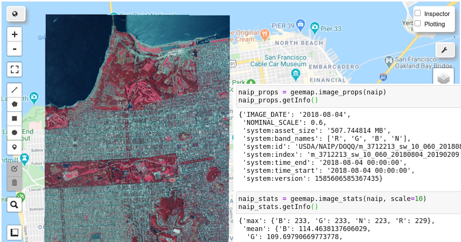
naip_props = geemap.image_props(naip)
naip_props.getInfo()
naip_props.get('NOMINAL_SCALE').getInfo()
Get image descriptive statistics
Including minimum, maximum, mean, standard deviation, and sum.
landsat_stats = geemap.image_stats(landsat, scale=90)
landsat_stats.getInfo()
naip_stats = geemap.image_stats(naip, scale=10)
naip_stats.getInfo()